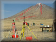
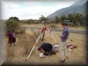
Determination of the Height of Ol Doinyo Lengai During the BESexpedition to Ol Doinyo Lengai the opportunity was taken to measure the height of the Mountain of God by transferring the height information determined using the Leica GPS with the high accuracy Leica TPS1200 Total Station.
Determination of the Accuracy of a Navigated GPS Point Both the Survey and Geosciences Fires were involved in collecting DGPS data to provide accurate height information for the Gravity Meter Survey during the expedition. This was carried out using Leica SR530 Survey GPS. Garmin handled GPS units were also used extensively throughout the five-week expedition for navigation. The opportunity was taken to investigate the accuracy of the hand held navigation GPS units.
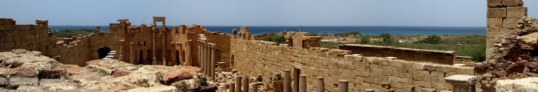
Geoscience Fire Projects – Rationale and Scientific Objectives The landscape of northern Tanzania is dominated by the East African Rift Valley and the Volcanoes of the Crater Highlands: it is a tremendously inspiring place to study Earth Sciences. Ol Doinyo Lengai is unique for its natrocarbonatite (sodium rich) lavas. A gravity survey of the Ol Doinyo Lengai was carried out with the aim of constraining its density structure and providing information about the composition of the volcano.
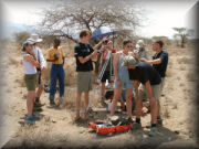
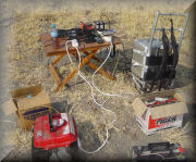
Field Gravity Measurements The gravimeter used is a relative instrument: it measures the difference in g between two locations. It was calibrated at the start and end of the expedition against the known absolute value of g at Arusha Airport. The calibration also allowed instrument drift to be checked and calculated. Simultaneous (differential) GPS data were measured by both the Geoscience and Survey Fires to obtain the accurate height differencesrequired between the Gravimeter stations.
Gravity Survey Results Fifteen measurements were acquired in a profile almost 100km long across the rift valley. This data was terrain corrected, at Edinburgh University using a regional digital terrain model for far zones combined with corrections obtained in the field for local zones. These data fit well with existing data from the region and, once the terrain corrections have been finalised will be supplied to BRG for addition to the regional database.
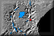
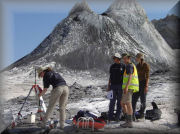
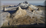
Observations from the Active Crater of Ol Doinyo Lengai Ol Doinyo Lengai is one of the more accessible active volcanoes in the world.
The expedition was fortunate enough to visit Ol Doinyo Lengai during a period of minor volcanic activity.
Acknowledgements, References and Appendix Acknowledgement of those who made the BESexpedition possible and a success. References to material used to write the reports and and Appendix detailing the equipment used and the lessons learned.
Science Report in Acrobat PDF Format To view this file you will require Acrobat Reader.
If you do not already have a copy, visit the Acrobatsite to download the version for your operating system. This is a large file so may take some time to load.