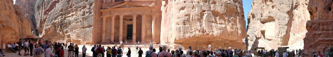
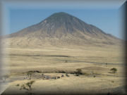
Photographs from the BESexpedition to the Gregory Rift and Ol Doinyo Lengai At two o’clock in the morning on 19th July 2004, 38 Young Explorers, with nine Leaders arrived at their camp site in the shadow of Longido some one hundred kilometres to the east of Ol Doinyo Lengai. These Young Explorers were a BES expedition who would walk across the savannah on the floor of the Rift Valley to Ol Doinyo Lengai then climb its steep flanks before trekking across the Crater Highlands to mankind’s birthplace at Oldupai Gorge on the edge of the Serengeti plains.
Science Report Science Report from the Geoscience and Survey Fires involved in the BES Expedition to the Ol Doinyo Lengai region of Tanzania in July and August 2004. Geoscience Fire Leader Ewan Laws Survey Fire Leader Hugh Anderson
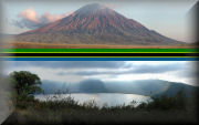
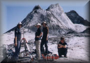
Megan’s Story … After a 6 hour, torch-light accent we were lost for words by the sight that met us, a white lunar landscape highlighted by the black streaks of new solidified lava. As we crossed the crater floor, which cracked like ice and crushed like snow, the drumming and swishing sounds of magma filled our ears like the continuous drums of Mordour. Theses were our first steps on the summit of Ol Doinyo Lengai …
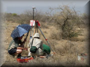
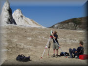
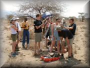
Digital Terrain Model Survey of Ol Doinyo Lengai Crater Both the Survey and Geosciences Fires were involved in measuring points in the crater of Ol Doinyo Lengai to create a Digital Terrain Model (DTM). The points used to create a DTM of the crater were measure in 3D using a Leica TPS1205 Total Station. The Young Explorers measured over 3000 points to provide the raw data for modelling the crater, from three Instrument Stations. The survey data was processed in LSS to create the 3D model of the crater floor and hornitos with the ability to dynamically view the data.
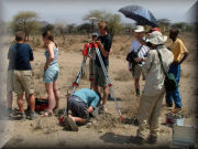
Differential GPS Measurements for Gravity Survey A primary science activity for the Survey Fire was to provide accurate height information for a Gravity Meter Survey to be conducted by the Geosciences Fire. In the event, both Fires worked together on this project. The most important consideration was the required accuracy of height measurements. The Gravity meter measures the pull of gravity and the last count on the dial is equivalent to a mere 0.03 metres in height so we needed to achieve relative heights between successive gravity reading of better than 0.1 metres with 0.03 metres as the goal.
Geomatics and the Mountain of God This article was published in Geomatics World Issue No 2 : January/February 2005 : Volume 13 Geomatics World January/February 2005