Today’s world appears to be very much in the clouds, whether it is data storage via the Internet or measured data in point clouds. Scanning is undoubtedly an excellent method for capturing large quantities of reliable accurate data in a very short space of time and with software such as that being promoted by Euclidian it is difficult to remember that it is not so many years ago that we were marvelling at “fly throughs”. This technology however has a significant cost implication and I feel that it is important that the development of low cost solutions continues to meet the needs of those who do not require large amounts of data.
Working as a Land Surveyor I found that there were perhaps too many occasions where I would arrive on site to stake out a building, plots or section of road only to find that no matter how hard I tried I could not get the data to fit the existing area on the ground. When the Customer was asked if a survey had been made of the site the usual response was no because it was too expensive so an existing map was used for the design process. Clearly a false economy as now they not only had to pay for a survey, but also for a redesign. This does illustrate that there are times when the cost of a service, perhaps because of the technology or equipment being used, can be considered too high for the application.
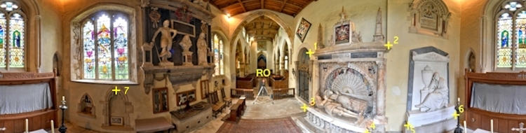
Developments in technology have made it possible for new activities to come into existence and the advent of affordable personal computers and digital photography coupled with software developed by talented people has enabled us to enjoy creating and viewing spherical (360°) interactive panoramas. The growth of this activity has been contributed to by the growth in Scanning as spherical panoramas are used to add colour to the points in the cloud. This is a useful method for Scanners without inbuilt cameras but can also be useful even if the Scanner does have a camera because the user has more control over the imagery and can even generate false colour panoramas or introduce colours from devices such as thermal cameras. Using a spherical panorama concentric with the Scanner centre removes any parallax issues.
These spherical panoramas are proving useful as a data source in their own right and some users who have used them to add colour to their point clouds are finding it advantageous to record them at other locations. In applications such as crime or collision scenes photographs are used to record the site, but by definition these are in a specific direction and limited to the angle of view of the lens, whereas the spherical panoramas provide a full 360° view. Taking a spherical panorama at the location of a drivers head for example immediately enables the viewer to see what the driver could see, even in their mirrors. If a picture is worth a thousand words then a spherical panorama must be worth ten thousand.
Recently there have been enquiries regarding using spherical panoramas for quantitative analysis. Some of these are on panorama forums, and I have received direct enquiries from viewers of my web site, and are from people outside of the Geomatics professions. (e.g. Geologists and Architects). As a result of these enquiries I have asked some of the authors of photogrammetric software if they plan to include the ability to extract measurements from spherical panoramas and the general response has been “yes, but not in the immediate future”. Consequently, I decide to explore the subject for myself and have published some of my findings on:
360° Panoramas for Photogrammetry
I am surprised by the reticence of the authors of photogrammetric software to include measurement extraction from spherical panoramas because as a result of my investigations I discovered that the mathematics involved is much more straight forward than that for extracting measurements from say stereo photographs where both Inner and Relative orientations were required before we could start to extract measurements.
The first stage in creating a spherical panorama is to merge and blend the images to produce an Equirectangular image using software such as PTGui and Immersive Studio. This Equirectangular is actually a projection rather than an image and has a single point of origin and a structured geometry. The Equirectangular projection has the property that meridians are equally spaced vertical lines and the circles of latitude are equally spaced horizontal lines making it ideal for measuring directions from the projection centre, but not very suitable for mapping for either navigation or cadastre because of the distortions.
We can think of a spherical panoramas in the same way as the Celestial Sphere. We know that the stars are not on a sphere with the earth at the centre, but we can treat them as such for navigation and position determination. We can reference each star by its Declination (angle above and below the ecliptic) and its Right Ascension (angle along the ecliptic from the reference point know as the First Point of Aries) at a given point in time. This data can be extracted from a Star Almanac. The ecliptic is the imaginary plane in which the planets of our solar system revolve around our sun. We can consider a spherical panorama in the same way with the horizontal plane through the panorama equivalent to the ecliptic, the angles above and below this horizon as Vertical Angles and the angles around this horizon as Horizontal Angles referenced to a known point in exactly the same way as if we used a theodolite.
It is possible to read off the pixel values using a graphics package, such as Photoshop or PSP, and calculate the Horizontal and Vertical Angles by simple arithmetic, but this is a very time consuming, error prone and laborious task because these packages are not designed for this application. Once the angles have been derived, co-ordinates can be calculated using trigonometry, and these calculations can be performed using a calculator or spread sheet. However, it would be much more satisfactory to have software specifically designed for this task.
Unfortunately my skills in software development and mathematics have be eroded over time through lack of use and I am now finding I can just about recognise the terminology, and I never did venture into the world of writing software to manipulate digital images, otherwise I would attempt to develop software to use spherical panoramas to extract quantitative data. So, the reason for writing this is in the hope that someone out there with the skills to write software to work with digital images and compute co-ordinates from intersecting rays in space will be willing to take up the challenge. Perhaps someone looking for a suitable project for a dissertation?
The basic requirement would be software to allow two (or more) Equirectangular projections to be displayed on the screen with the ability to zoom and pan round the images with a magnifier box for the cursor location, so that the pixel co-ordinates can be extracted. Something similar to the “Control Point” editor in PTGui. Then, calculate the Horizontal and Vertical Angles and compute their intersections. The software would also need to provide the user with some feedback as to the precision of the computed points based on the angle of intersection because this information is not that intuitive when viewing the Equirectangulars.
It is easier to recognise common points in the respective panoramas when viewing them as interactive spherical panoramas (e.g. SWF files) than as Equirectangular projections so a more sophisticated approach would be to use the spherical panoramas to read the directions of the points of interest.
If the software to perform these tasks was marketed in the same price bracket as other related software, such as PTGui and Pano2VR, this would provide a practical low cost method of for measuring 3D points. The equipment required to create spherical panoramas can be purchased for around £1K, and if a camera body that a fisheye lens can be attached to is already owned, this amount can be halved.
There are also “single shot” cameras currently coming onto the market, such as the iSTAR from NCTech, making the acquisition of spherical panoramas (Equirectangular images) a straight forward process so I believe that we are seeing only the beginning of interest in the possibilities of using this method for measuring 3D points.
I therefore pose the question:
Are there any practical cost effective solutions already in existence and if not, are there people out there willing to take on this challenge?
Hugh Anderson ~ August 2013
![]()